
Amicalola Falls to Springer Mountain
Spring is here and I am super excited about our plan to hike the third leg of our Appalachian Trail Adventure this season.
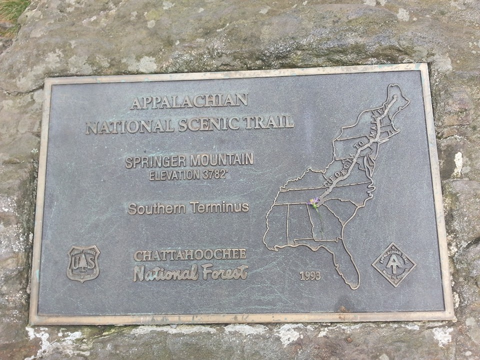
Our whole family loves being outside, and since we have the mountains and the Southern Terminus of the AT practically in our backyard, a few years ago we devised a plan.
We decided we wanted to hike the AT as far as we could go in short, day or weekend segments.
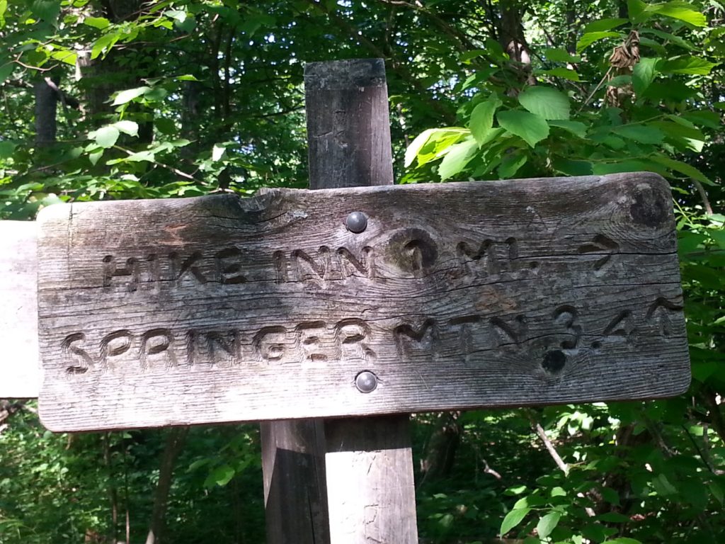
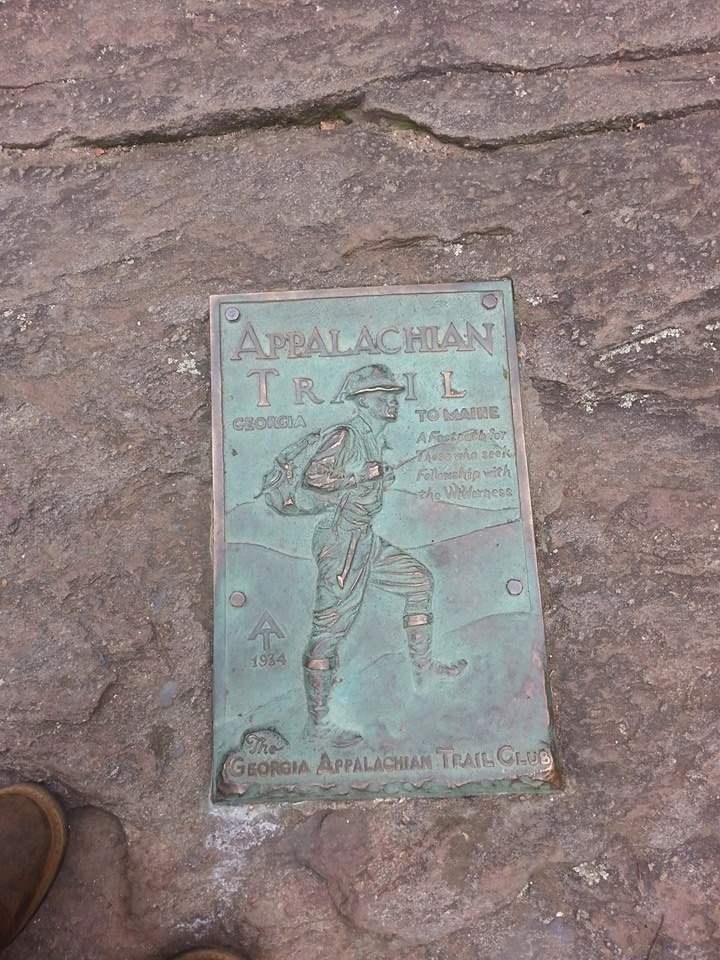
Our first leg would be the Appalachian approach trail. Amicalola Falls to Springer Mountain.
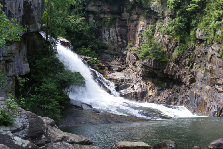
There are a couple of different ways to begin this hike. From Amicalola, you can start behind the Visitor Center at the very beginning of the AT approach trail or you can park in the lot at the top of the falls and catch the trail from there.
We chose the latter. The climb up the 604 stairs to the top of the falls is a great challenge at the end of which you will encounter breathtaking views of the mountains but we opted to skip it on this trip.
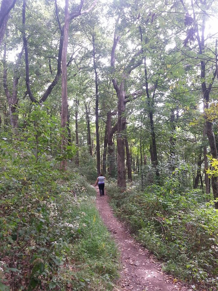
We began our hike from the parking lot at the top of the falls.
The trail is 7.2 miles from the top of the falls to the Springer Mountain Summit. Start early and double that of course if you are going round-trip. On weekends the falls and the trail are usually buzzing with day hikers and backpackers.
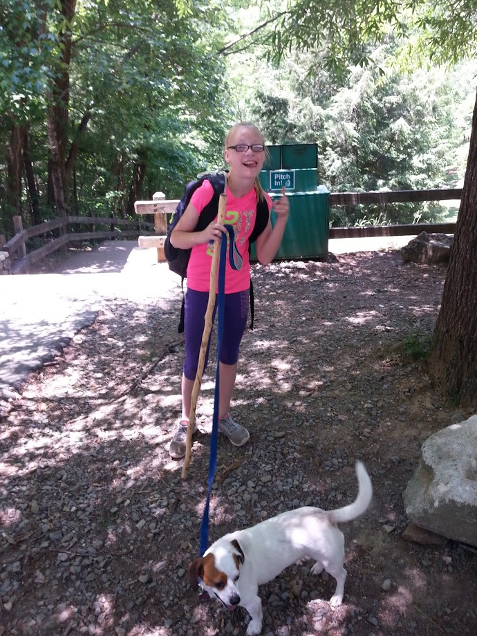
On this trip, we brought our three youngest children (at that time 10, 15, and 17) and our up-for-anything pooch, Emmy.
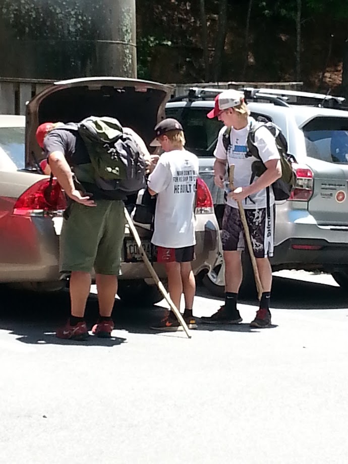
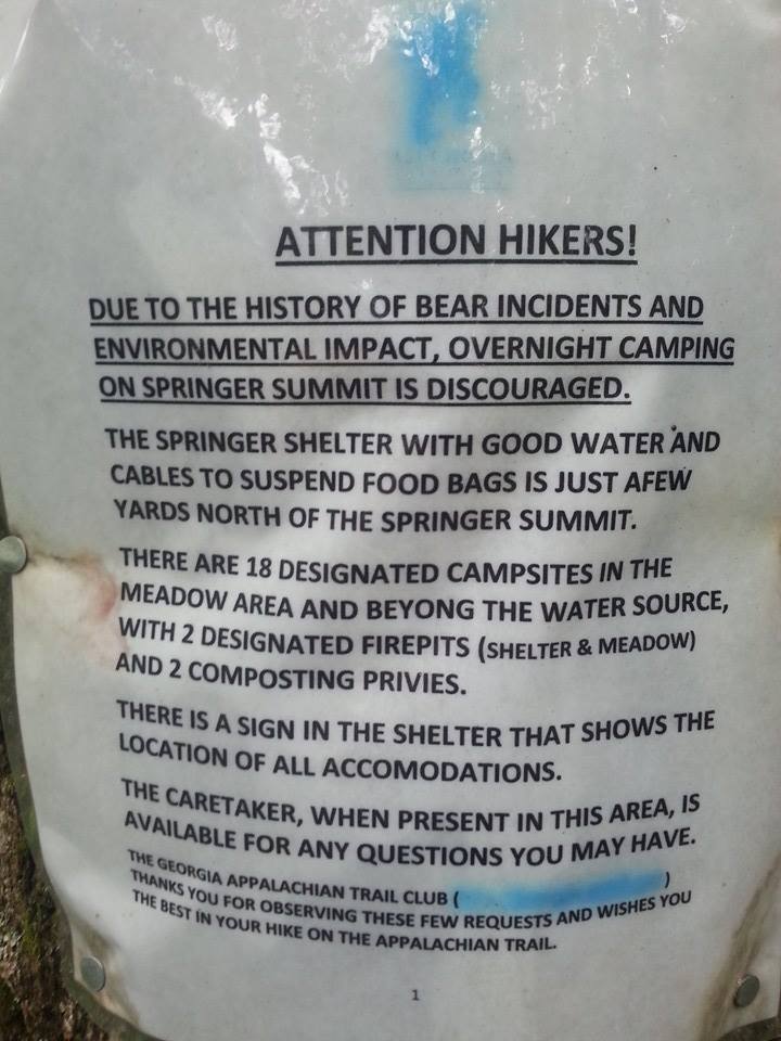
Being locals, we parked a second car (with a cooler full of ice, extra water, Gatorade, and ham sandwiches) at the Springer Mountain Parking lot (off USFS 42, one mile north of the Springer Mountain Summit) where we would finish today’s trek. Total distance – 8.1 miles.
So I don’t know about you but “approach” to me says “leading to”…as in the path leading to the ACTUAL trail, right? Bahahaha!
I consider myself to be a pretty practiced hiker. Maybe somewhere between stroll in the woods and the guy I know who runs 50k trail races. When this trip was taken I was doing 3-5 miles a day at least 4 days a week at a local trail, so I was feeling pretty good.
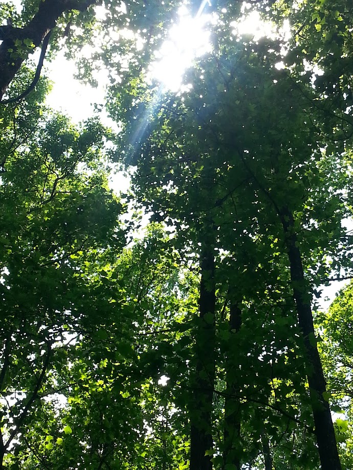
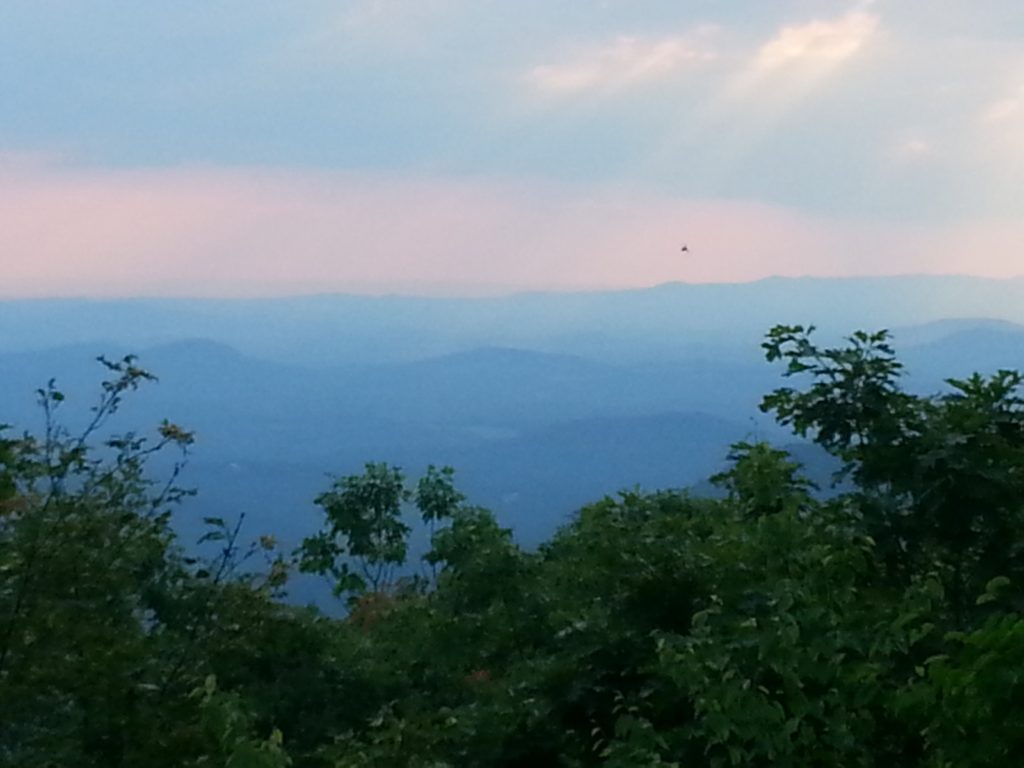
Before I continue I have to tell you…this trail is amazing! The Springer Mountain Summit is breathtaking and so worth every single second of the hike but y’all…I would be lying if I were to pretend that I didn’t die twice and quit three times in the first quarter mile!
It was slightly more challenging than I had expected or mentally prepared for. There was even a moment where I leaned against a tree, dropped my pack on the ground, and decided I just wasn’t going to be able to do it!
Of course, I didn’t mean that. I’m no quitter! My ego was a little bruised but I was not going to let this little 8.1 beat me! Those t-shirts that say “I will not quit but I will cuss the whole time!”? Made for me!
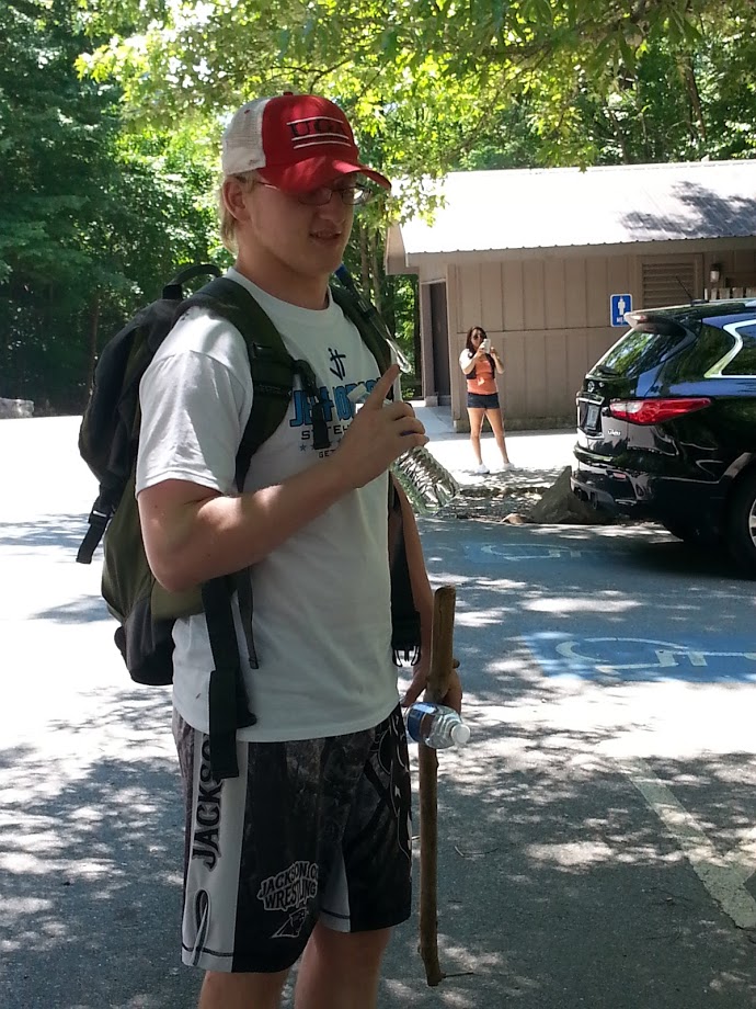
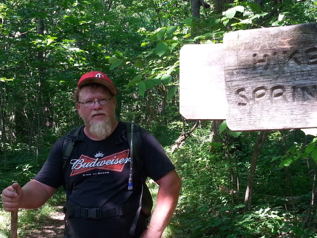
My boyfriend, who had hiked the AT approach trail before, quickly assured me that it would become somewhat easier if I could just make it a little further.
No matter how tough you think you are, invest in a bladder pack. On this
To start, my pack was heavy. I made everyone help me drink the bottled water first to lighten my load. I also figure I didn’t do a great job at rationing water. It was hot, I was thirsty. I drank A LOT. Bring plenty of water.
- Hydration Bladder 2 Liter
- Gelindo Insulated Hydration Backpack Pack with 2.5L BPA Free Bladder
- Mubasel Gear Insulated Hydration Backpack 2 Liter
My boyfriend and I actually ran out of water around mile six if I had to guess. Fortunately, on this particular trail, there is a neat little place where you can access fresh water straight out of the ground.
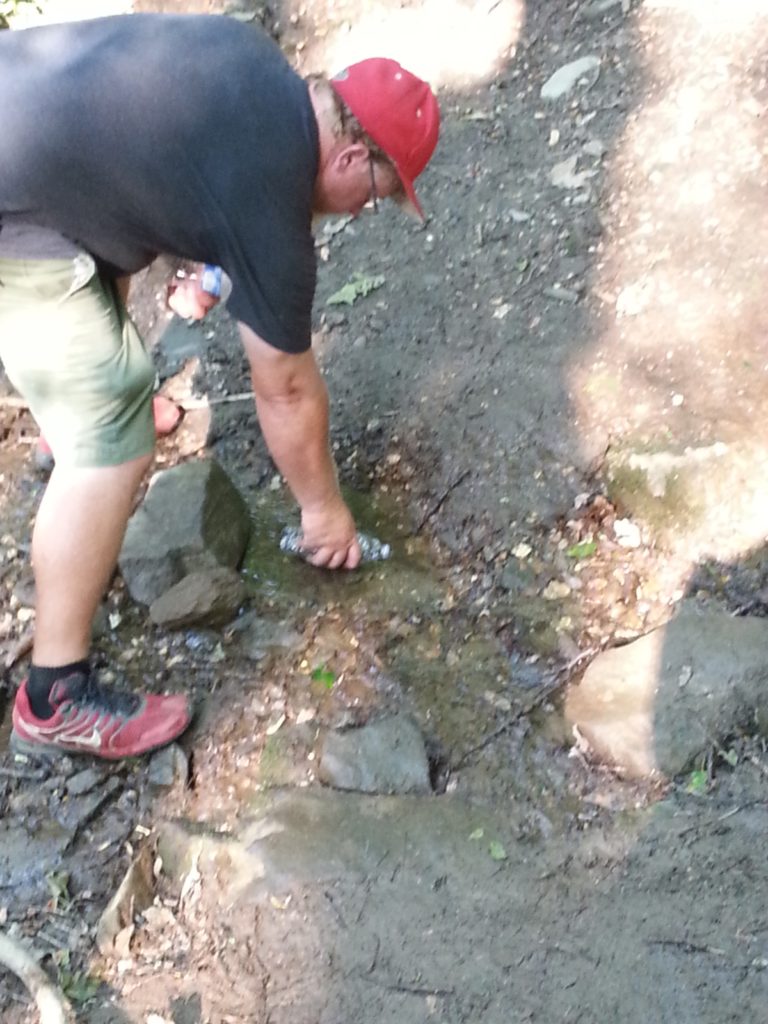
Getting water on the trail. 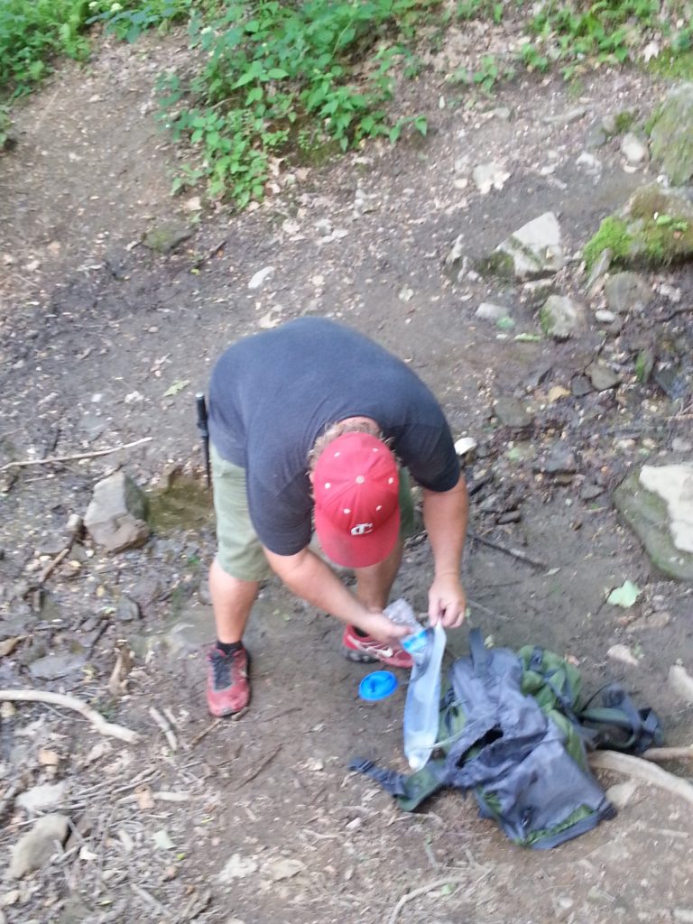
Filling up our water.
Now there are several ways to determine whether the outdoor water you’re going to drink is likely contaminated and there are a few ways to ensure that it’s not. (Tablets, filters, Etc.) If the idea of it makes you uncomfortable I might suggest stashing some of these in your bag.
- LifeStraw Personal Water Filter
- POTABLE AQUA Water Purification Tablets
- LifeStraw Universal Water Filter Bottle Adapter Kit (Fits Select bottles from Hydroflask, Camelbak, Kleen Kanteen, Nalgene and more.)
- Katadyn Water Filter (For personal or small group camping, backpacking or emergency preparedness)
- RoryTory 5pc Survival Straw Water Filters Camping Hydration Purifier Set
I grew up in the country and I’m generally okay with “roughing it” a little. On that day, any reservations I had about drinking water straight from the earth were completely overshadowed by my raging thirst.
The water was crystal clear and surprisingly cold. I said a quick prayer about my immune system and drank shamelessly. We filled up our pack and a couple of the empty bottles we were carrying and forged ahead.
The kids would hike ahead a little then wait for us to catch up. Meanwhile, Emmy, the dog, would run back and forth between us, trying her best to keep an eye on her “pack”.

Emmy 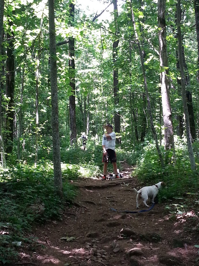
Emmy and Joe on the trail.
A lot of the AT approach trail is uphill. With an elevation gain of approximately 1791 feet over the 7.2 miles, we learned quickly to savor the moments when it would smooth out a little, taking the time to catch our breath and refuel on fresh fruit, granola bars, and beef jerky.
At one point I turned around to see my boyfriend about 50 feet behind, strolling along, savoring a single slice of a Granny Smith apple he’d carefully procured with his pocket knife. He still swears that was the best apple he’s ever eaten.
For me, it’s always about the journey. Him? It’s mostly a race to see how quickly we can get there on the shortest, most direct route possible so I was glad to see him slow down and soak up the moment.
I’m sure we took a lot longer than most to complete the trail that day. The kids finished about a half hour ahead of us too. But, the journey was exhilarating! And we did it! Leg one complete!
I’ve found that there are few things that compare to the feeling of completing something, especially something challenging that requires reaching beyond your comfort zone to push the limits of what you know yourself to be capable of.
Hike On!
Trail Facts:
- Difficulty: Moderate to Strenuous
- Distance: 7.2 miles from the top of Amicalola Falls to Springer Mountain Summit + .9 miles from Springer Mountain Summit to Springer Mountain Parking (off USFS 42, one mile north of the Springer Mountain Summit)
- Elevation Change: (+)1791 feet over 7.2 miles, (-)384 over the last .9 miles
Trail Maps
- Official North Carolina and Georgia Appalachian Trail Maps
- MAP GUIDE – Appalachian Trail, Springer Mountain to Davenport Gap [Georgia, North Carolina, Tennessee]
- Appalachian Trail Complete Set of Topo Map Trail Guides National Geographic Trails Illustrated Waterproof Map Guides

Quite interesting. I really loved going to your website. Many thanks.
I appreciate you taking the time to create this post. It has long been extremely helpful to me in fact. Appreciate it.
I really like this post a great deal. I will certainly be back. Hope which i will be able to read more helpful posts then. Will be sharing your understanding wonderful my associates!